Set of photos created by Lois Francis for use in Stroud Valleys schools.

Shows the catchment area of the River Frome and how it is a tributary of the R. Severn. Descending a steep scarp slope gives it a lot of power to turn water wheels that turn hammers that tighten the cloth to make felt. The scarp slope gave rise to the Stroud textile industry along with the fact that cloth makers found Gloucester too expensive to operate in when having to pay Guilds.

Isaac Taylor’s map of Gloucestershire shows the lack of roads directly joining Stroud to the River Severn. Roads were in poor condition and muddy enough to swallow a horse. The River Severn was a free river with no tolls charged on goods transported on the river. Coal was brought down from Staffordshire on the river but getting it to Stroud was difficult using poor roads and the River Frome’s level of water was much reduced in the summer causing the mills to stop work because the water wheels could not turn.

The textile industry used coal to heat water for felting and dying not for steam engines at this point in time. Indeed the Stroud valley textile industry was very slow to change to steam engines.

Horses could not carry on their backs as much as a boat could.

The Stroud painting is in the Stroud Museum in the park and shows the sequence of cloth making from boats landing coal at wharves to cloth hanging on racks.


A Proposal for Completing the Cutting &c from Chippenham Splat to Wallbridge made by Robert Perry


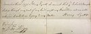
A handwritten report of the opening

How the opening was reported in the Gloucester Journal.


D1180-10-25-1


D1180-10-36 from Gloucestershire Archives


Part of the case of the opposition to the Bill as presented in Parliament.

Part of the case of the opposition to the Bill as presented in Parliament.

Barge Irene awaiting tide on the River Severn before leaving the Stroudwater Canal at Framilode