The name Missing Mile was given to the section of canal between Bristol Road Lock and Westfield Bridge after it was infilled during the construction of the M5 motorway c1970.
This section of canal did not pass any habitation - just fields associated with a farm in the hamlet of Westend, Eastington. Historically, most of the fields were permanent grass, some grazed by cows for fattening and others by sheep. The towpath was open to the neighbouring fields and there were towpath gates at field boundaries.
The low-lying meadows below the canal usually produced a crop of hay each year, and some stacks were built near the canal so that the hay could be sent away by boat if appropriate. Some boat owners going to the Midlands to collect coal were glad to take a ready cargo rather than travel empty, but the hay had to be piled high above the gun’le to make a worthwhile load and then the boat was top heavy and difficult to steer.
One curiosity beside the river is a clump of willow trees just south of the motorway embankment. This was formerly on the other side of the river in the centre of a meander which has been cut off and now just appears as a ring shaped depression around the trees.
During the Second World War, the fields were taken over by the local War Agricultural Committee, and they ploughed up much of the grassland above the canal to grow more food.
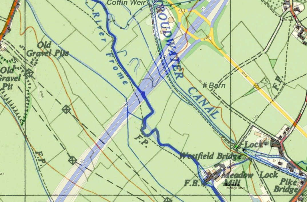
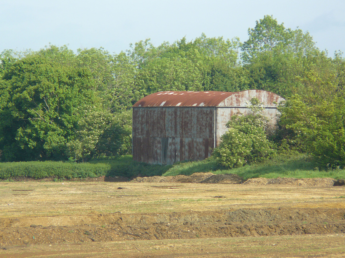
After the war, the fields reverted to grass again with a mixture of cows and sheep as before. To make better use of the hay crop, a baler was used for gathering the hay and a Dutch barn was built for storage (see map).
The barn happened to be close to the site of a Roman villa, and when holes were dug for the barn's uprights, many Roman coins were found. Recent archaeological excavations have identified ditches associated with historic field boundaries and enclosures, pits, postholes, a possible stone structure, and a number of human burials.
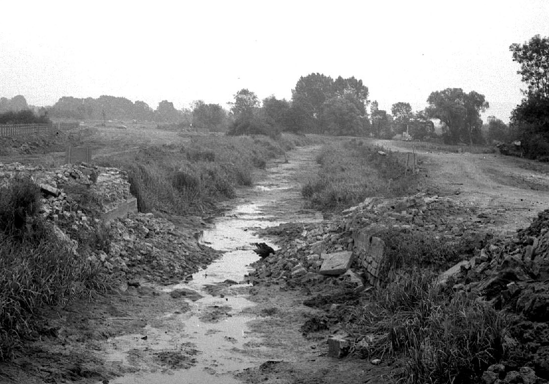
When the motorway contractors arrived in 1969, they worked very quickly. The canal was drained, the mud was moved to a former gravel pit on the other side of the valley and the channel was refilled with fresh earth. While this was going on, one farmer was alarmed to find his cows had disappeared. After a search, he was relieved to see them on the other side of the river, having crossed by the contractor's temporary bridge.
To replace the canal as a source of water for cattle, the contractors were obliged to provide drinking troughs for the upper fields and a hard ramp down to the River Frome for the lower fields. This section of the motorway opened in 1971.
For the current restoration project, a new channel will be dug across the fields and two new locks will be built so the canal can pass through the existing arch under the motorway alongside the River Frome.
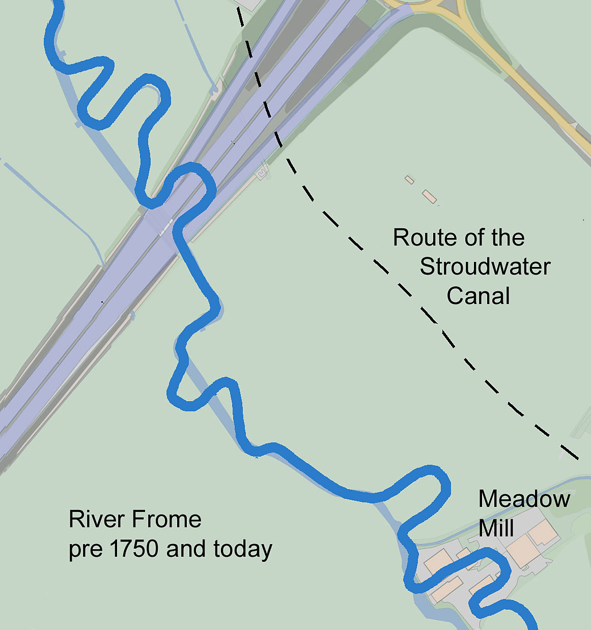
In the eighteenth century, there was much opposition to building a canal along the valley of the River Frome as the mill owners feared that the use of locks would reduce the water available to work their mills.
To overcome this opposition, John Kemmett started to make the river itself navigable in the 1750s by installing a crane beside each mill weir that could lift goods from a vessel at the lower level to another at the higher level. At the same time he straightened the river by cutting off many of the former meanders.
Unfortunately, he soon found that the effort involved in repeated cargo handling at each mill weir was not economic, and the project was abandoned before it was completed. However, some traces of his work can still be seen, particularly just north of the modern motorway where the route of one former meander is marked by a line of trees.
Memories of farming changes and building the motorway from Geoffrey Martin.
Roman remains from Geoffrey Martin and cotswoldarchaeology.co.uk/2000-years-at-home-forest-greens-roman-villa/
Photo of drained canal by Lionel Walrond, digitised by Dr Ray Wilson, licenced under CC-BY-NC-SA 4.0.
Information on John Kemmett's Navigation from The Stroudwater Canal by Michael Handford.