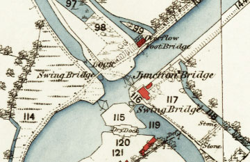
At Saul Junction, the Stroudwater Canal (running from north-west to south-east) is crossed by the Gloucester ship canal, originally known as the Gloucester & Berkeley Canal and later as the Gloucester & Sharpness Canal.
Forming the Junction in the 1820s involved building a new lock to raise the level of this section of the Stroudwater Canal by about five feet. This huge undertaking created a unique crossing of two independently owned canals, and opening bridges carried the towpath of each canal over the other. There were also two sets of stop gates in the Gloucester canal to allow water levels to be lowered if necessary for maintenance.
The Junction is now maintained as an attractive area for visitors (with Green Flag status) and the Cotswold Canals Trust runs a visitor centre nearby.
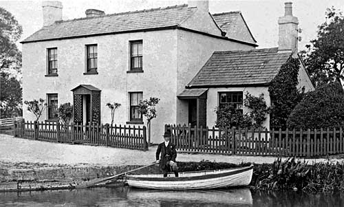
The house beside the Junction was occupied by the official who opened the bridges and recorded traffic passing from one canal to the other. He also collected tolls on vessels that were not travelling the full length of the Stroudwater Canal.
The extension on the right provided him an office in which can still be seen the desk he used, although it has been moved from its original position immediately behind his security screen. For the role of the toll clerk, visit Toll Collection and Rates.
The office is now used by a Canal & River Trust employee who opens the bridge on the Gloucester canal while sitting at a modern desk, monitoring the scene by closed-circuit TV.
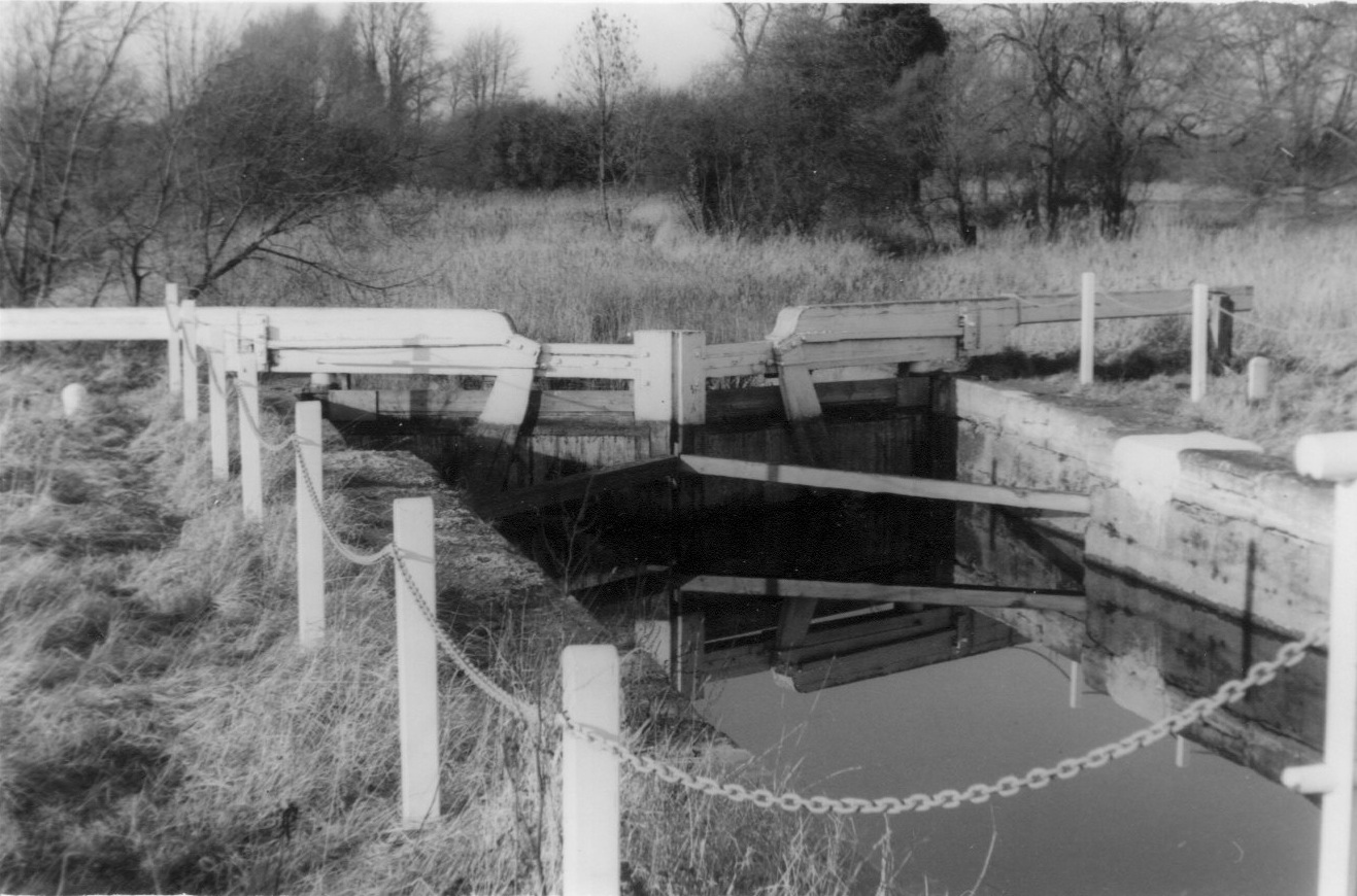
The lock was built in the 1820s to raise this section of the Stroudwater Canal by about five feet to suit the level of the new Gloucester ship canal. Unlike the other Stroudwater locks, the gates have sluice openings with pivoting boards worked by rack and pinion gears to control water flow. The resident engineer in charge of forming the Junction had recently worked on the Lancaster Canal where this design was common.
As traffic on the canal between Framilode and Saul Junction died out in the twentieth century, the lock gates were left to rot. However, the unusual design of the lock led it to be registered as a Listed Building, and in 2016 it was restored by the Canal & River Trust as an amenity feature.
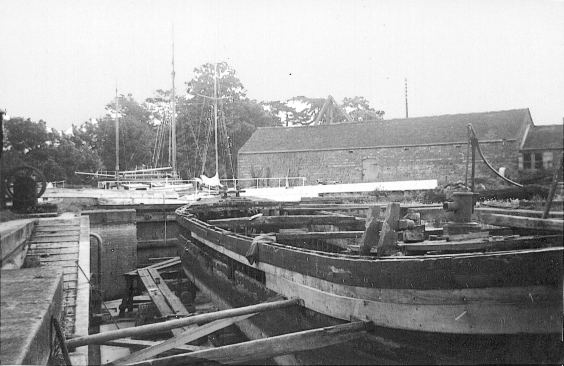
The dry-dock, cutting across the southern corner of the Junction, was built in 1869 for repairing coastal vessels. It originally had opening gates at both ends so it could be used to allow a steam dredger to pass through to the Stroudwater Canal once a year, as the original canal entrance was not wide enough.
The land to the south of the dry dock developed as a boat building and repair yard, mainly servicing coastal vessels but also some canal barges and narrowboats. In recent years, the site has adapted to build and service modern leisure craft.
The swing-bridge that once provided access between the boatyard and the Stroudwater towpath is no longer used, but it was recently refurbished as a heritage feature.
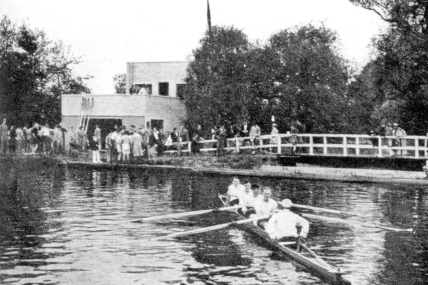
The original club house was built in 1936 and extended in 1961 to provide rowing facilities for the pupils of Wycliffe College at Stonehouse. School races are commonly held on the straight reach north-east of the Junction, but longer races are also organised that attract crews from all over the country.
For a time during the Second World War, the building was taken over by the Royal Air Force as a base for fitting out air-sea rescue launches and other marine craft prior to them being put into service. The building was fitted out with workshops, and vessels in transit were stored along the Stroudwater Canal.