From the track crossing Stonepits Bridge can be seen the complex drainage arrangements in this part of the Frome Valley. (For sources, see end of page.)
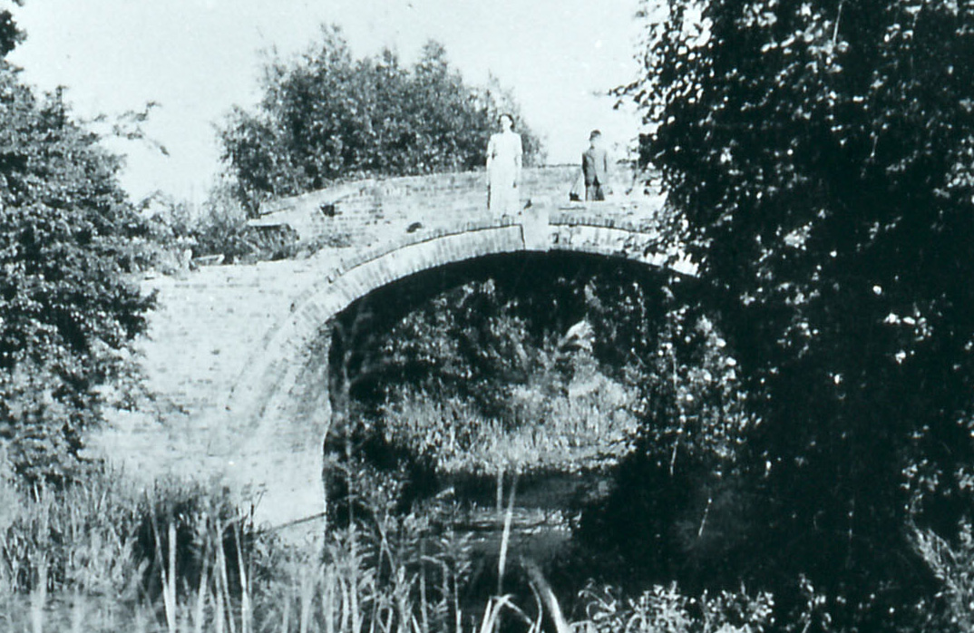
Now often spelt with a double t, this bridge takes its name from the field to the east where stone was extracted in the past. It carries an ancient track across the valley from Whitminster to Frampton on Severn, and it also gives access to the low lying fields that were associated with Kidnams Farm in the village of Whitminster.
In the last quarter of the nineteenth century, the off-side bank near the bridge was regularly used for sheep washing by the tenant of Kidnam's farm who paid an annual charge. However, there were occasional difficulties, particularly after he allowed other farmers to do the same without paying and again when the canal bank was badly damaged by the sheep and the annual charge was increased to pay for it.
The original hump back bridge was replaced by concrete pipes in 1955. The present restoration project is planning to replace these pipes with a lift bridge.
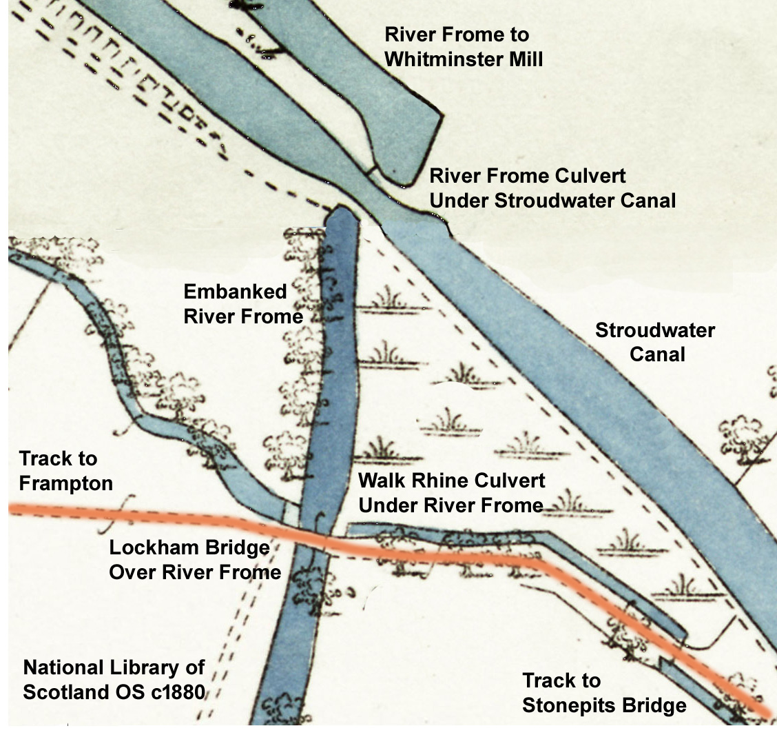
The construction of the Stroudwater Canal added an extra complication to the complex drainage arrangements in the Frome valley. The river itself was highly embanked on its way to Whitminster Mill, leaving the low lying fields to be drained by ditches locally called rhines (pronounced reens).
The main rhine passed through a culvert under the embanked river adjoining Lockham Bridge which carried an ancient track across the valley over the river. When the Stroudwater Canal was built, it crossed the river at what was called an aqueduct and further north it also crossed over the rhine. The track passes the remains of a small Second World War pillbox, where the sound of water trickling over a nearby canal spill weir can often be heard.
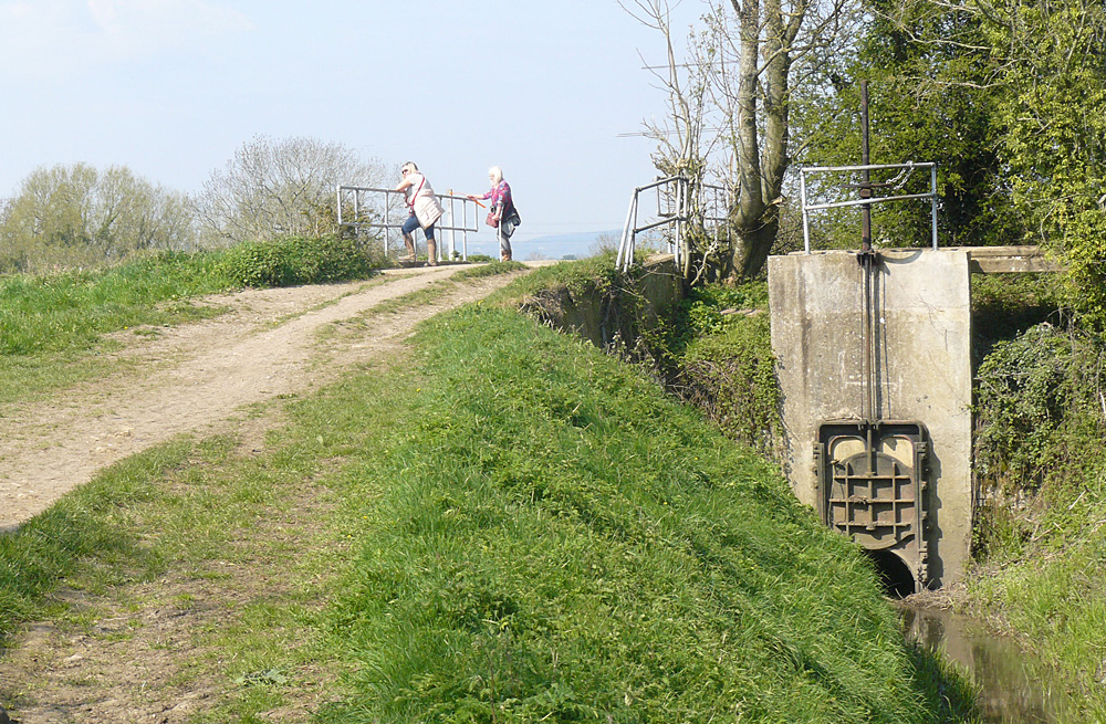
At the same time, the aqueduct was cleared away to give the river a smoother path, and a length of the canal was filled in. A consequence of this is that towpath walkers currently need to make a short diversion along the track to cross the river via Lockham Bridge.
Difficulties with sheep washing from D1180/9/7 p211 and 9/9 p78.
Replacement of original bridge from D1180/acc12710/box5/6, 25 May 1955.
For flood alleviation scheme, see D1180/9/56 and K2017.